Site Master Plan

Planning for the Future

of the Watervliet Shaker National Historic District

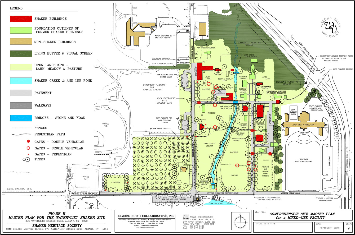
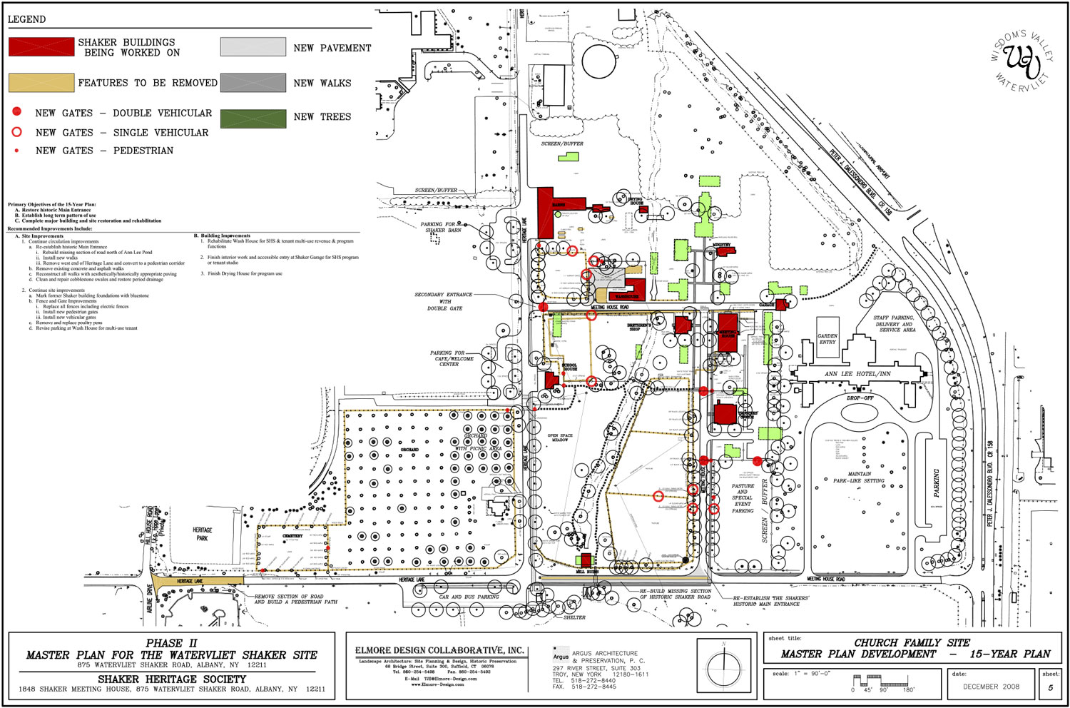
In 2007, Shaker Heritage Society completed a Site Master Plan that puts into motion a clear outline of recommendations to turn the historic site into a thriving mixed-use facility with commercial, recreational, and educational opportunities. The Plan provides a road map for the Society to create an economically viable resource that enhances quality of life for local residents and encourages economic development through heritage tourism.

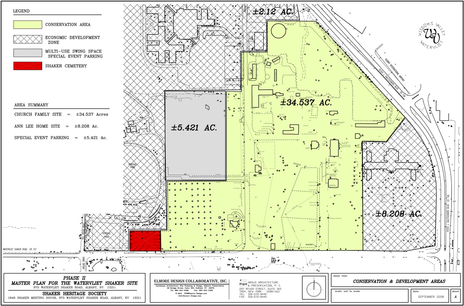
Presently, the Shaker buildings and landscape, known as the Church Family Site, are owned by Albany County, are underutilized, and are not fulfilling their potential. The goal of the Site Master Plan was to articulate a vision that would turn the site around. The Plan includes a Conservation Policy that established an internally consistent framework of principles for evaluating proposed plans and actions that will affect the historic resources and their context.

The Master Plan

The Church Family Site was divided into a 34.5-acre Conservation Area to be utilized by the Society and all adjacent properties into an Economic Development Zone to be developed by Albany County.

The Conservation Area was divided further into different Use Areas and Activity Zones that directly relate to the existing layout and use of the site by Society and by the Shakers during their residency. These uses and activities were refined into a 15-year Comprehensive Site Master Plan that is divided into three 5-year increments.

As a result, the aesthetics of the site will come to life and its sense of place will be re-established. The site will once again be a living entity where people fill the spaces and their noises fill the air. This project was recognized with a 2009 Merit Award from the Connecticut Chapter of the American Society of Landscape Architects.

Since 2007, the Society has used the plan to guide its work as it undertook several building stabilization projects and worked to reduce adverse impacts of new development within the historic district.

A series of maps and construction cost estimates were developed to support the recommendations and to illustrate the topics of discussion.

Image module
Image module
Image module
Image module
Image module